World-Class Navigation,
Deployed Instantly.
A seamless, web-based experience that helps your visitors find their way instantly.
From Blueprint to Live Navigation
A streamlined implementation path designed to get your venue live without disrupting your daily operations or requiring expensive hardware.
Instant Upload
Upload your existing floor plans directly to our platform.

Our tools help you quickly convert your venue layout into a high-fidelity, interactive map yourself in just minutes.
“Upload → Map ready.”
Point-of-Interest Setup
Define key locations like clinics, lecture halls, or boarding gates.
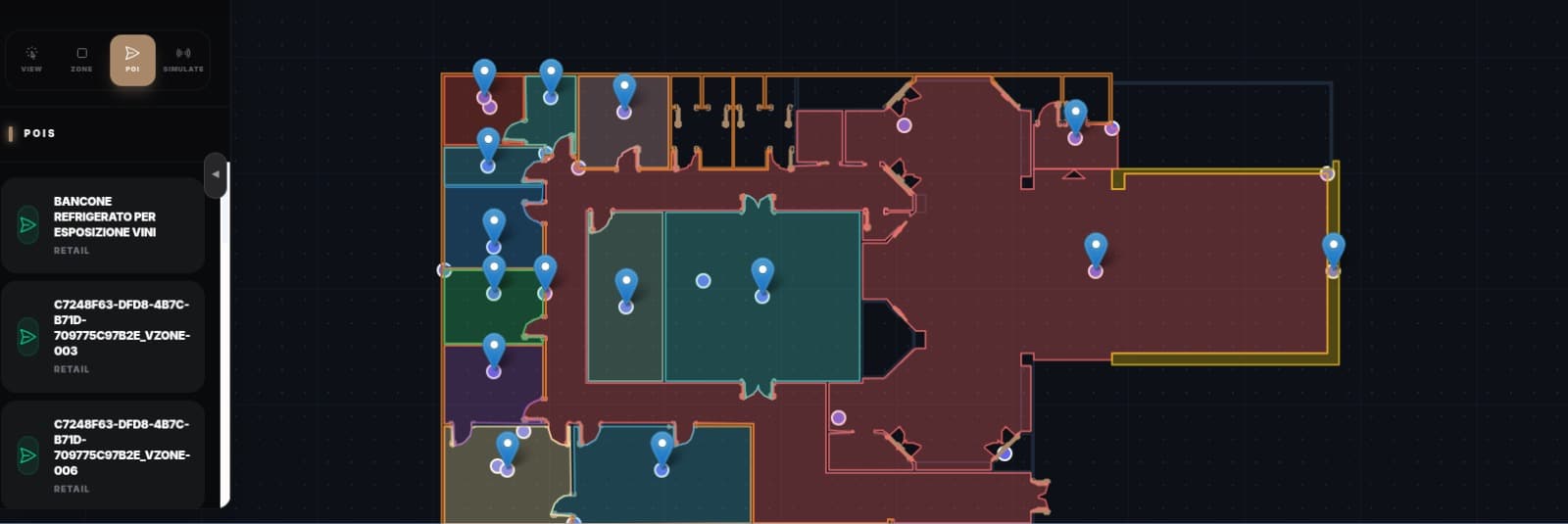
Add rich metadata, accessibility notes, and real-time status updates for every important room in your building.
“Searchable venue directory.”
Launch instantly
Deploy via web-link or QR codes for an onsite interactive experience.
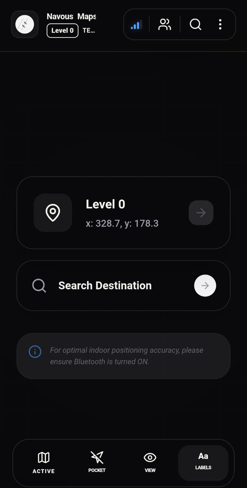
Visitors navigate your venue instantly in any browser. No app downloads required.
“Scan & Navigate onsite.”
Built for Complex Venues
Whether it's a high-stress medical environment or a sprawling university campus, Navous is engineered for the unique challenges of your industry.

Hospitals
Reduce missed appointments and patient stress with clear, turn-by-turn directions to clinics, labs, and pharmacies. Improve staff efficiency by guiding them through the fastest internal routes.
- Patient-first navigation
- Staff route optimization
- Accessibility routing

Universities
Help students and visitors find lecture halls, libraries, and campus amenities on day one. Modernize campus tours and ensure every building is accessible to everyone.
- Campus-wide wayfinding
- Building-to-room routing
- Event-based directions

Airports
Streamline the traveler journey from security to the gate. Direct passengers to retail, dining, and lounges, increasing secondary revenue while improving on-time departures.
- Gate-to-gate routing
- Retail & Lounge discovery
- Real-time flow analytics
Venue Intelligence
Navous doesn't just show a map—it provides the spatial infrastructure to run a more efficient, safer, and more profitable venue.
Safety & Security
Instantly identify crowd density and high-traffic bottlenecks. Guide security or medical teams via the most efficient routes during emergencies.
Facility Maintenance
Equip your maintenance and cleaning crews with precise indoor navigation to reported issues, reducing downtime and operational friction.
Visitor Satisfaction
Provide patients, students, or travelers with the confidence of knowing exactly where they are and how to reach their destination.
Commercial Growth
Direct foot traffic toward retail hubs, dining areas, and amenities. Use spatial data to optimize tenant placement and lease value.
Ready for Enterprise-Scale Deployment
Whether you manage a single hospital wing or a global network of international airports, our platform is built to scale. No complex hardware audits or months of calibration required.
The Pillars of Spatial Intelligence
Converting complex engineering into high-impact value. Our platform is built on five pillars of spatial infrastructure.
Spatial Frame Mapping
We map physical structures into a high-fidelity geodetic frame of reference, ensuring perfect alignment between local metric space and global coordinates.
Positioning Engine
A robust spatial engine that fuses inertial movement with multi-path signal environment data through geodetic coordinate anchors.
Enterprise Integration
An event-driven integration layer that connects the indoor map to venue operations and autonomous logistics.
Spatial Analytics
Providing actionable business intelligence through high-fidelity spatial data analytics.
Economic Realization
Quantifiable value realization through automation, safety, and performance-based alignment.
Common questions from
facility operators.
Everything you need to know about visitor access, deployment timelines, and institutional control.
Will visitors need to download an app before arrival?+
What if we don't have a floor plan?+
How quickly can a facility go live?+
Does this require beacons or any hardware installation?+
Can routing handle accessibility and mobility needs?+
How is visitor privacy protected and who owns the data?+
Ready to map your building?
Reach out and we'll turn your floor plans into a live walkthrough you can test with your team. No app to build, and no pressure to pretend the pilot is further along than it is.